
Pahrump ZIP Code Directory Coverage
USPS’s current labeling list places 89041, 89048, 89060, and 89061 in the Pahrump label or container area. That confirms a postal association, not four exact town-boundary polygons. The research did not locate official USPS text that assigns a precise street or neighborhood boundary to each of the four codes. For a specific address, use the official postal lookup instead of inferring coverage from a general label list or from a map image.
| ZIP | Areas Covered | Post Office | Notes |
|---|---|---|---|
| 89041 | Included in the current USPS Pahrump label list | No specific office identified in the researched USPS text | Exact street or neighborhood boundary was not located |
| 89048 | Pahrump postal label area | Pahrump Post Office | Postal city label and Pahrump CDP geography are different concepts |
| 89060 | Included in the current USPS Pahrump label list | No specific office identified in the researched USPS text | Exact street or neighborhood boundary was not located |
| 89061 | Pahrump label area | Homestead Post Office | Exact street or neighborhood boundary was not located |
This Pahrump directory therefore uses the postal label as a search aid, not a claim that every address inside a code lies in the same town, precinct, parcel area, or delivery route. A Pahrump mailing label can coexist with a different geographic layer. Note: Confirm the current code from USPS when a record depends on an exact delivery address.
Pahrump Postal Labels and Town Lines
A ZIP code is designed for mail processing. Pahrump, however, is an unincorporated town and census-designated place in Nye County. The research treats the Town of Pahrump, the Pahrump CDP, county boundaries, parcel lines, subdivisions, and voter precincts as separate geographic layers. The town’s official page places Pahrump in the southeast corner of Nye County, while Census figures apply to the CDP. Neither fact draws an official postal boundary for a particular address.
USPS ZIP Code Lookup is the source for a current address-level postal check.
Use the postal result as one layer of a Pahrump address check, then compare it with Assessor and GIS data when the question concerns a parcel, town boundary, or public record.
The USPS ZIP basics material also explains that ZIP+4 and address standardization are part of delivery addressing, and that changes can take 30 to 60 days. Do not use an old envelope, a PO Box label, or an inferred map edge as the final answer for a current address.
Pahrump Assessor ZIP Searches
The Nye County Assessor Property Inquiry can narrow a parcel search by owner, house range, street, city, and ZIP. Its portal help describes eight-digit parcel IDs without dashes, while account numbers use two letters plus six digits. Use the ZIP as a filter after entering an address or other reliable term. The result is an assessment record, not proof that an owner, mailing recipient, or named party currently lives at the property.
Nye County Assessor Property Inquiry shows the verified search options used for a Pahrump ZIP-filtered property search.
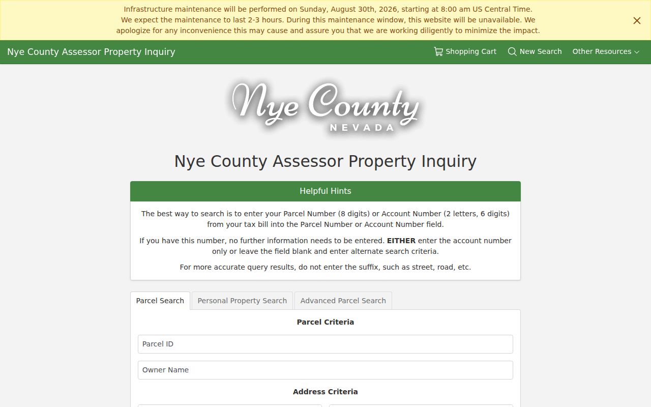
The Assessor screen is useful for narrowing a parcel search by postal field, but the address, owner, and parcel information still need source-date and record-type context.
| Field Label | Type | Required | Options or Format Notes |
|---|---|---|---|
| Parcel ID | Parcel identifier | No | Portal help says eight digits without dashes. |
| Owner Name | Name | No | Use only as one search path; it is not an occupancy field. |
| House Number Low/High | Address range | No | Pair with street name to narrow an address range. |
| Street Name and City | Address text | No | Available in the parcel-search path. |
| ZIP Code | Postal filter | No | Use with other terms rather than as evidence of a town boundary. |
Advanced parcel searching adds value, acreage, sale-date, land-use, building, and physical-characteristic fields. Those fields help locate a record but should not be used to make a claim about current residence or personal circumstances.
Pahrump GIS and Postal Context
The Nye County Planning FeatureServer supplies the county’s structured geographic layer list. Documented layers include addresses, permits, streets, easements, parcels, county and town boundaries, commissioners districts, voting precincts, schools, zoning, and planning overlays. The service can place a postal-address question beside parcel and government geography, but it does not publish a verified ZIP polygon in the research reviewed here.
The Nye County GIS service identifies the address, parcel, boundary, and precinct layers available for Pahrump context.
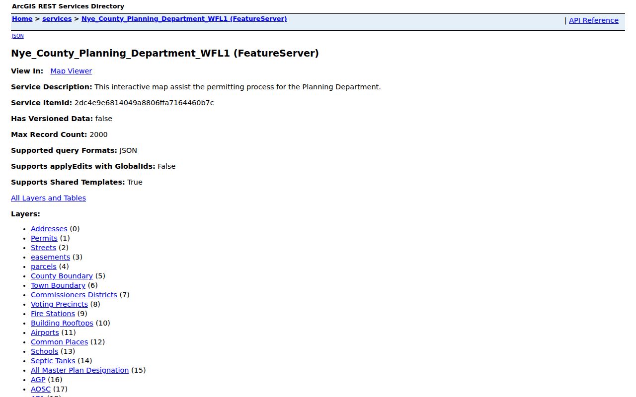
The GIS layer list helps separate a Pahrump postal label from a parcel, street, precinct, or town-boundary question before a reader treats the map as an answer.
A careful map check begins with a permitted public address or parcel, then compares the address, parcel, boundary, and precinct layers. Verify a name through the Assessor or Recorder rather than treating a map label as identity evidence. A map polygon is not a survey, ownership record, or proof of occupancy.
Finding Residents in a Pahrump ZIP
A ZIP filter works best after the question is narrowed. The Assessor can use the postal field with address, street, or owner terms; GIS supplies address and parcel context; USPS confirms the current delivery code; and the Nye County Clerk controls voter-list requests. A ZIP-wide result should be read as a list of records matching a postal field, not a verified roster of people who live in that area. For current street-by-street research, use the Pahrump street directory after the postal search has narrowed the location.
- Enter the full address in the official USPS address lookup to confirm the current delivery ZIP.
- Search the Assessor by house range, street, city, and ZIP, or by a known parcel ID.
- Inspect the GIS address and parcel layers, then compare town-boundary and precinct overlays when those layers matter.
- Request a defined voter-list format from the Nye County Clerk under NRS 293.440 only when the record purpose supports it and protected fields are excluded.
- Use the Recorder index only when a recorded document is needed, then verify dates and document context with the custodian.
The Pahrump street directory gives the fuller address-by-address workflow once a ZIP search points to a particular street or parcel. The Recorder’s online index reaches from the previous day back to 1986; contact the Recorder for earlier material. Online, phone, mail, in-person, archive, and NRS Chapter 239 request routes remain available when a portal does not supply the needed record.
Pahrump Post Offices and PO Boxes
The Pahrump Post Office is at 2300 Postal Drive, Pahrump, NV 89048-9998, with a listed phone number of 775-727-7055. Posted retail hours are Monday through Friday 8:30 a.m. to 5 p.m. and Saturday 9 a.m. to noon; PO Box access is listed as 24/7. This office information supports mail and ZIP verification. A PO Box shows mail access and should not be described as someone’s physical address.
USPS’s Pahrump Post Office listing provides the official location, hours, phone, and PO Box information for 89048.
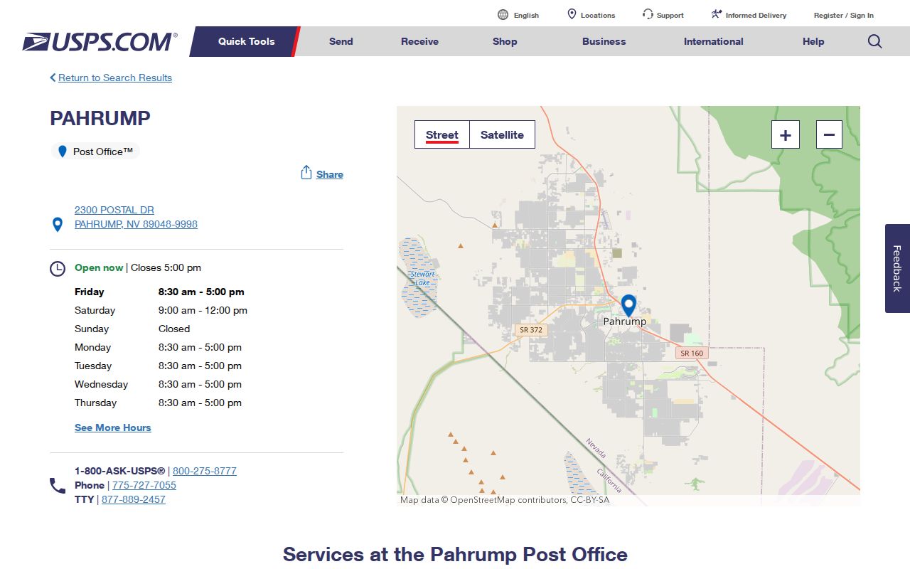
The 89048 office record is a postal-service source, so use it for delivery and office questions rather than as a neighborhood boundary map.
The Homestead Post Office is at 3001 E Kellogg Road, Pahrump, NV 89061-7988, with a listed phone number of 775-727-8815. Posted hours are Monday through Friday 9 a.m. to 4 p.m., with weekend closure. The office supports the 89061 postal context identified in the research, but it does not establish the exact street extent of the code.
USPS’s Homestead Post Office listing supplies the official 89061 office information.
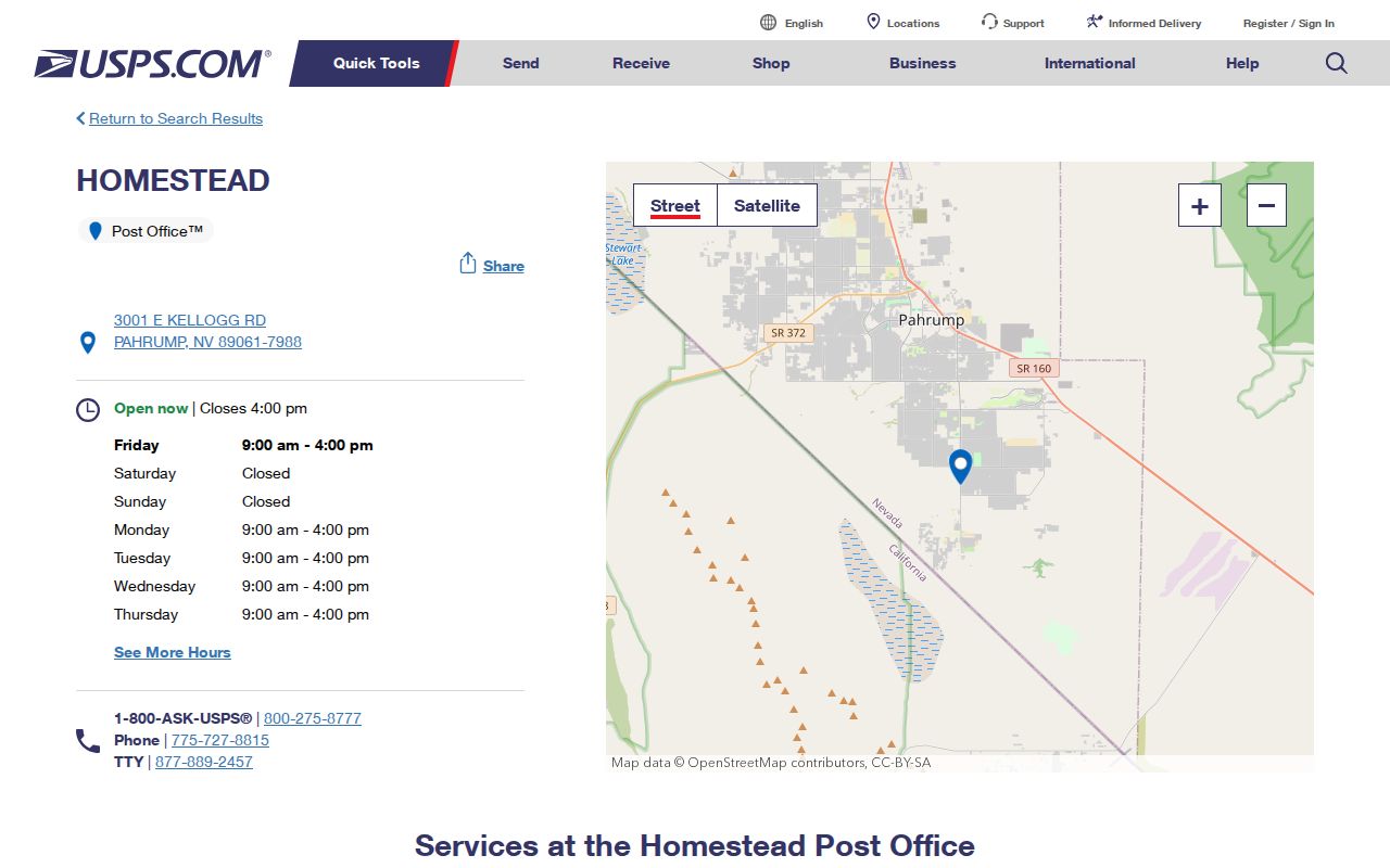
The Homestead listing connects 89061 with a documented Pahrump postal office while leaving unverified street-level boundaries to USPS address lookup.
Pahrump ZIP Boundaries and CDP Geography
No official exact ZIP boundary was verified for Pahrump in the source material. The current labeling list supports four Pahrump postal codes, while the Town of Pahrump, Pahrump CDP, county parcels, subdivisions, and voting precincts answer different geographic questions. The 2020 Census QuickFacts figure of 44,738 refers to the Pahrump CDP, not to any postal code. Its land-area measure also differs from another Census profile calculation, so those measurements should not be mixed or assigned to a ZIP.
- ZIP and ZIP+4
- A ZIP identifies a postal delivery area; ZIP+4 adds more delivery detail. USPS should confirm both for a current address.
- PO Box ZIP
- A postal code used for box service. It is mail access, not a physical-location claim.
- Unique ZIP
- A code assigned to a single organization or facility. No unique Pahrump ZIP is asserted here without a USPS source.
- Carrier route
- A delivery-route grouping used by postal operations. It is different from a town, parcel, precinct, or resident boundary.
For current address resolution, normalize the address with USPS, check the Assessor house range, street, city, and ZIP fields, query the GIS Addresses and Parcels layers, and inspect boundary or precinct overlays. For a historic address, compare telephone-directory and local-history material with plats, maps, newspaper archives, and the appropriate county custodian. Mark a conversion as unresolved until a county, USPS, Recorder, Assessor, or archival source supports it.
Pahrump ZIP Privacy and Record Limits
ZIP-focused research still has privacy limits. NRS 293.440 permits a request for a registered-voter list from the county clerk at the statutory per-name fee, but NRS 293.558 protects Social Security numbers, driver-license or identification numbers, and election email. Address and phone information can also be withheld through the statutory written-request framework. A statewide voter-status portal is for the voter’s own status, and the reviewed research did not expose its embedded field labels.
The Nevada Confidential Address Program provides a substitute address and mail forwarding for qualifying participants. A substitute address or a fictitious election address must not be reverse-engineered into a physical location. Public availability never authorizes intimidation, surveillance, repeated unwanted contact, or attempts to infer a protected address. Note: Request only the defined record and nonprotected fields that the custodian permits.