
Pahrump Street Directory: Work From an Address
A street-by-street search works best when each source has a clear role. The Assessor can connect an address to an assessment parcel. GIS supplies the surrounding streets, parcel geometry, and local boundary layers. The Recorder can connect a parcel’s legal description to recorded instruments. Registration material has separate access rules and should never be treated as a complete household list. This order keeps the Pahrump street directory focused on evidence rather than inference. It also avoids confusing a property owner, a document party, a mailing contact, and a current resident.
- Enter the address in the Nye County Assessor Property Inquiry and preserve the parcel ID, legal description, and date viewed.
- Use the Nye County GIS FeatureServer to compare the address, streets, parcels, and town or precinct layers.
- Read the assessor result as an assessment record. A displayed owner or mailing address is not proof that the person lives at the address.
- Search the Recorder index by the recorded parties or document details tied to the parcel, then check the instrument before drawing a conclusion.
- For a historical household question, take the date and location to the library, museum, history project, or UNLV collection instead of assuming a reverse directory exists.
That sequence is useful for family research, estate questions, consumer-safety checks, and understanding a block’s public land records. It does not turn an address into permission to contact or profile people.
Pahrump Street Directory Assessor Fields
The county’s Property Inquiry portal is the most direct Pahrump address starting point. Its basic parcel search accepts a parcel ID, owner name, house-number low and high values, street name, city, and ZIP code. The help text describes parcel IDs as eight digits without dashes. Personal-property searching is a different account system, so it should not be presented as a real-property or resident result. Advanced controls can narrow by values, acreage, sale information, land use, physical characteristics, and other assessment attributes.
| Assessor search | Observed fields | Careful use |
|---|---|---|
| Parcel search | Parcel ID, owner name, house-number range, street, city, ZIP | Find the assessment parcel behind an address. |
| Personal property | Account, owner, parcel, asset serial, address range, street, city, ZIP | Keep an account result separate from land ownership. |
| Advanced parcel | Parcel and account ranges, values, acreage, sale date, land use, building details | Use only to narrow property research, not to infer residence. |
The Nye County Assessor maintains maps, tax rolls, ownership updates, and assessment information. Its Pahrump office is at 160 N Floyd Drive and lists 775-751-7060. When a result matters, record the date viewed because assessment data changes.
The official Assessor Property Inquiry shows the fields available for Pahrump street directory research.
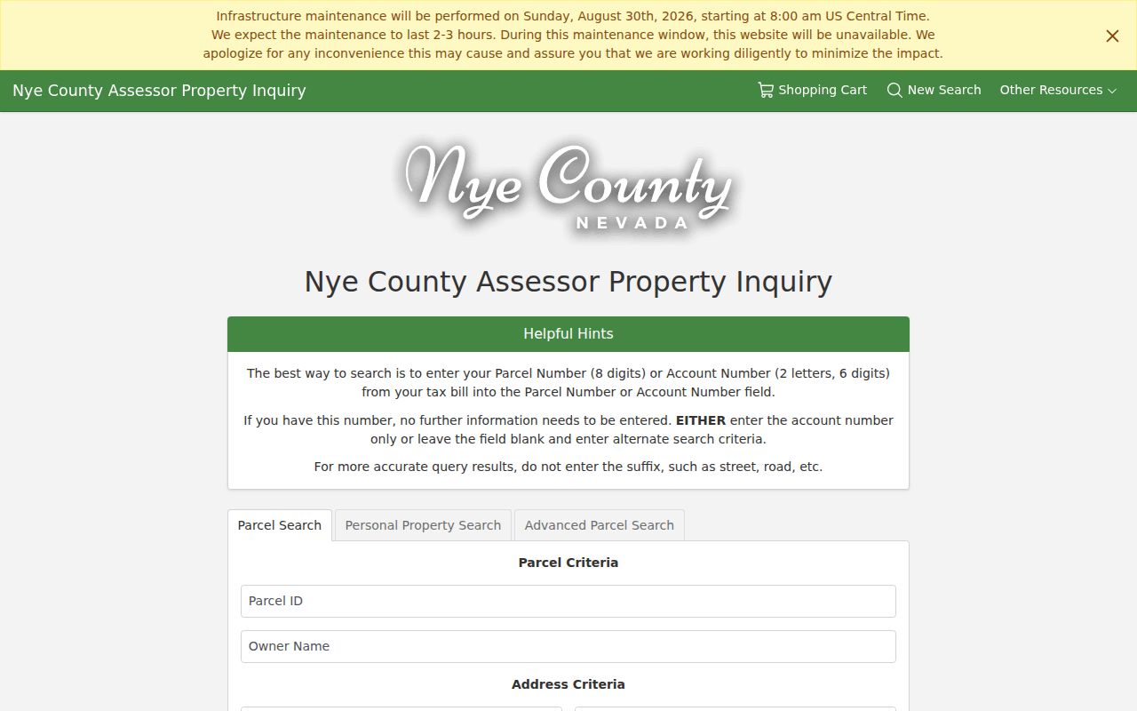
The image supports a field-level search approach, while the returned assessment record still needs its own date and source context.
Pahrump Street Directory GIS Layers
The county GIS service is the Pahrump street directory bridge between an address and its geography. The official layer list includes Addresses, Streets, Parcels, easements, permits, county and town boundaries, voting precincts, fire stations, schools, zoning, master-plan designations, and overlays. Its technical query controls include layer ID, a where clause, object IDs, geometry, out fields, result offset and count. The public map interface did not expose a captured live address result, so a map label should be checked against the Assessor or Recorder before a name is associated with a parcel.
A practical map review starts with the address layer, then compares the parcel and street layers. Boundary and precinct overlays can explain why two nearby addresses are handled by different public systems. The parcel polygon describes mapped land, not occupancy, ownership proof, or a survey. The county’s 2011 Pahrump/Bell Vista/Woodchips/Filly/Mesquite map is a dated assessment-map example, not a current ownership card.
The Nye County Planning FeatureServer displays the layers available for Pahrump street directory mapping.
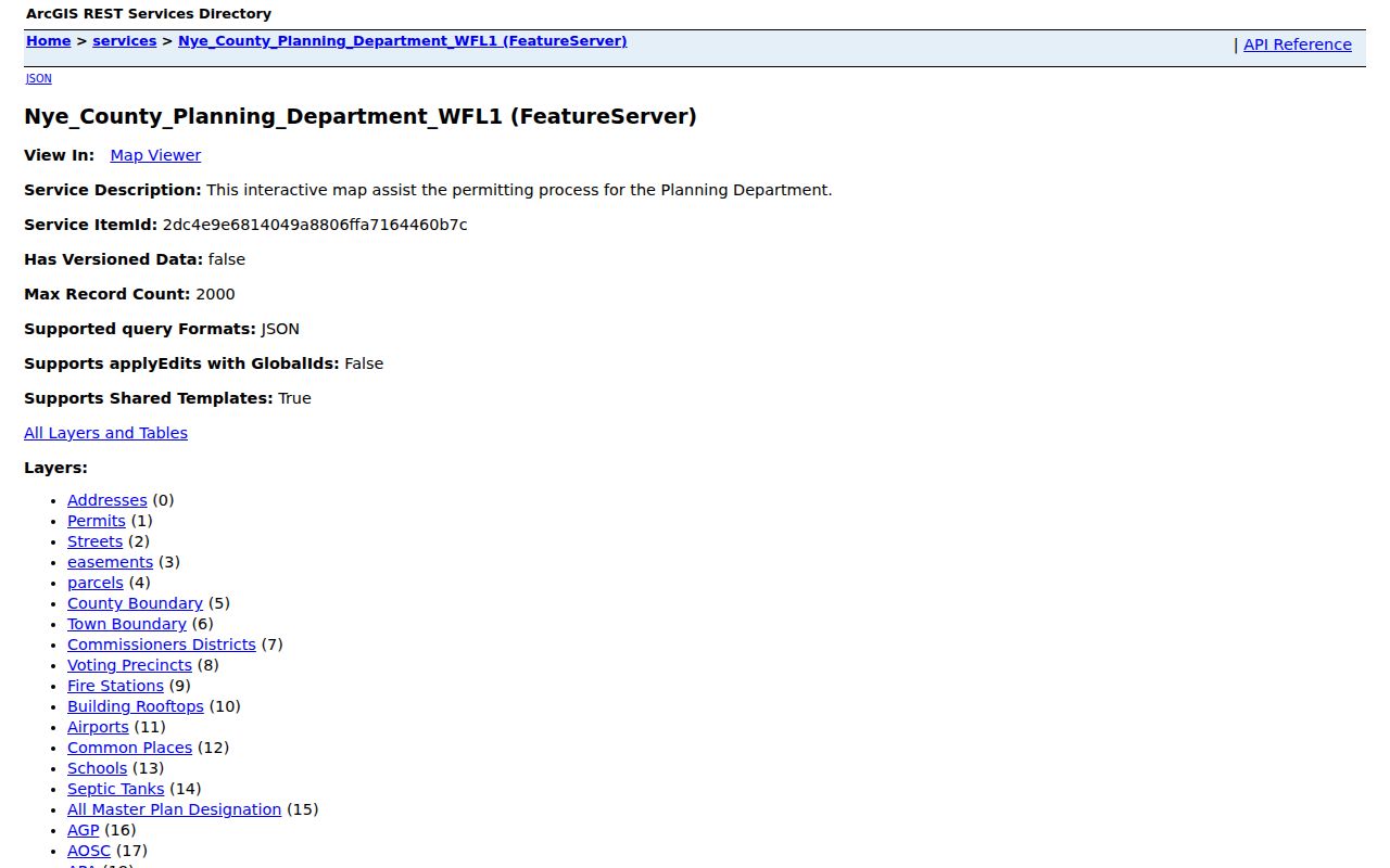
Use the map as a location check, then return to the responsible record custodian for a recorded document or assessment detail.
Note: A GIS feature can place an address or parcel in context, but it does not establish who lives there.
Pahrump Street Directory Record Paths
Several Pahrump records can be searched by street or joined through a parcel. Their results answer different questions. The coverage below separates the public source, its keeper, and the limit that matters most. Code Compliance requires an exact address or APN and a description for a report, but that public workflow is for reporting a condition, not identifying residents. Similarly, a recorded party may be a grantor, grantee, trustee, lienholder, beneficiary, or signer rather than a person who lives at the parcel.
| Address record | Custodian | What it can establish | Access route |
|---|---|---|---|
| Assessment parcel | Nye County Assessor | Parcel connection, owner field, map and assessment context | Online portal, Pahrump office, phone |
| GIS address and parcel layers | Nye County Planning | Street, parcel, boundary, precinct, planning context | FeatureServer and map viewer |
| Recorded documents | Nye County Recorder | Instrument parties, document number, Book/Page, legal trail | Online index, registered route, copy request, office |
| Registration list | Nye County Clerk | Statutorily available list subject to exclusions and withholding rules | Defined request under NRS 293.440 |
| Code report | County Code Compliance | Address or APN required for a reported condition | OpenGov route, office, or contact |
For records that are not available online, the documented fallback chain is the office counter, phone or fax clarification, a Recorder mail-copy request, historic map or newspaper research at a library or archive, then a focused Nevada Public Records Act request under NRS Chapter 239. Describe the record class and date range rather than asking an agency to identify every person linked to a street.
Pahrump Street Directory and Voter Lists
Nevada distinguishes voter-status confirmation from a voter-list request. The Secretary of State voter-status portal is the official statewide route, but the embedded field labels were not captured in the research. Nye County’s registration guidance states that applicants provide a residential address and may provide a different mailing address. It also makes clear that a PO Box or business address is not automatically a residential address. Those rules do not make a public street list a complete directory of everyone at an address.
Under NRS 293.440, a person may request a registered-voter list from the county clerk for the statutory per-name fee. Social Security numbers, driver-license or ID numbers, and election email are protected. Address and phone withholding may apply on written request, and the Confidential Address Program has special fictitious-address treatment. The Nye County voter-registration page identifies Clerk, mail, and in-person access routes, including local distribution points for applications.
The Nye County voter-registration information illustrates the rules that bound a Pahrump street directory search.
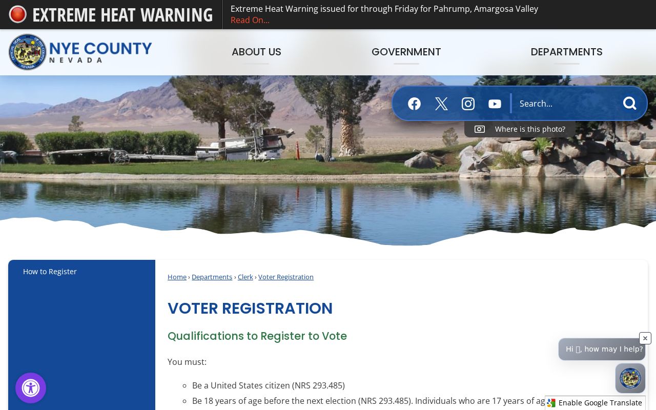
Registration information is best used through the official process and with protected fields left out of any notes.
Pahrump Street Directory Deed Trail
The Nye County Recorder index adds the legal-document trail to a Pahrump street directory search. The Recorder describes the index as a library-card-catalog type locator rather than the underlying instrument. Try alternate spellings and name order. The research documents online index coverage from the previous day back to 1986, with images added daily. Public Login is described as recorded-document search access without images; image or printing access may require registered or subscription access.
A search can start with the owner field and legal description from the assessment record, then look for a purchase deed or related instrument. The index may identify document number or Book/Page for a copy request. A mailed request needs the document number or Book/Page, number of pages, and appropriate fee, according to the Recorder copy-request instructions. Earlier records require a call or visit to the Tonopah office. The Recorder’s Pahrump office is at 170 N Floyd Street, Suite 1, and lists 775-751-6340.
The Recorder disclaimer is a useful reminder that an index entry is not the document itself.
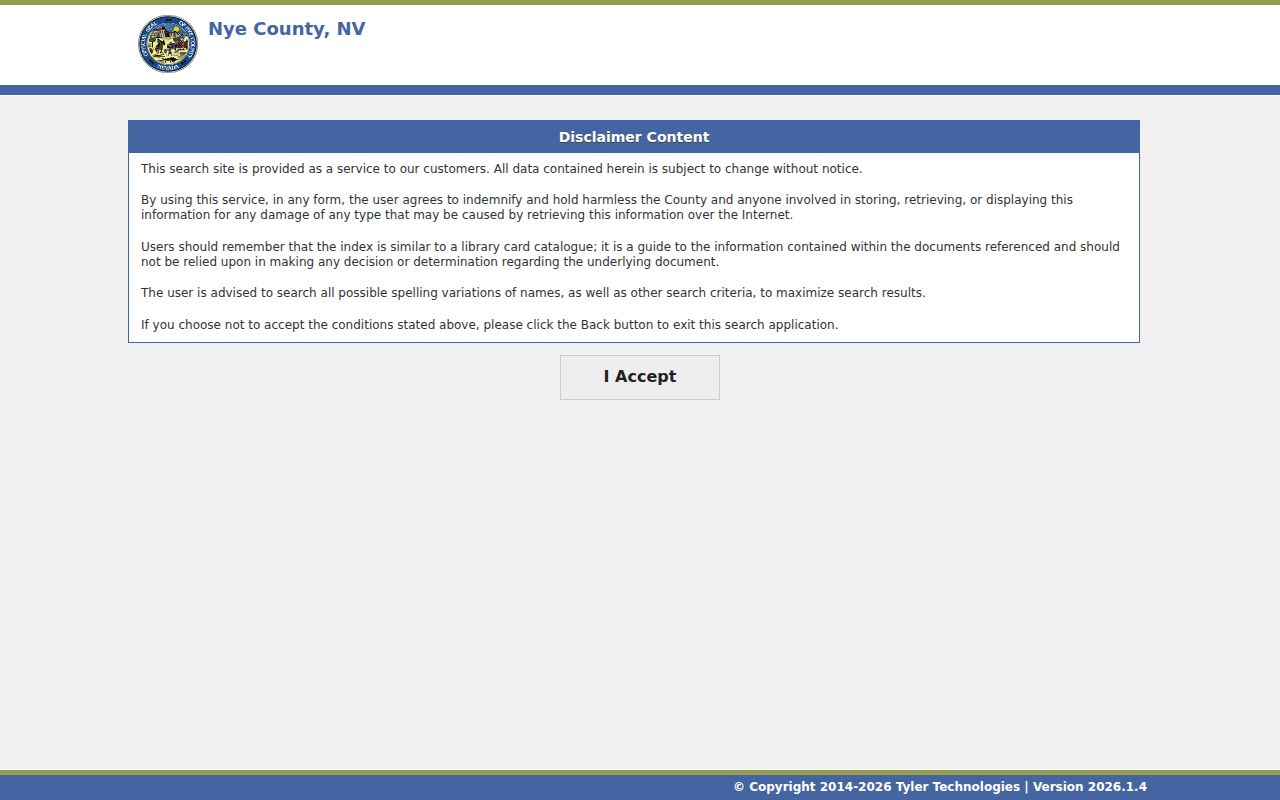
Confirm the instrument and its date before treating any recorded name or return address as evidence about a Pahrump address.
Note: The Recorder’s current notice says Friday eRecording ends effective September 18, 2026, so recheck operational details before relying on them.
Pahrump Street Directory Address Geography
Pahrump uses several overlapping address systems. USPS delivery addressing, assessor situs and mailing fields, GIS points, parcels, ZIP labels, precincts, and town or county boundaries each answer a different question. The current USPS labeling material associates 89041, 89048, 89060, and 89061 with Pahrump, but the labels are not a town-boundary map. Check a current delivery address with the official USPS ZIP Code Lookup, then compare it with the assessor and GIS records.
- Parcel
- A defined piece of land used by assessment and mapping systems. It is not a roster of people.
- Situs address
- The location address associated with a parcel. It can differ from the owner’s mailing address.
- Plat
- A land map that shows legal-map information and parcel geography. An assessor plat is not a survey.
- PO Box
- A mail-access address, not evidence of a person’s physical location.
The Pahrump Chamber street-map page can help orient a visitor to present street names. For an old address, compare the source date, road or subdivision name, and mapped parcel context. No authoritative historical street-renaming or renumbering crosswalk was found, so an unproven old-to-current conversion should remain unresolved.
Pahrump Street Directory Historic Leads
Older Pahrump address research needs a different route. The local history material documents a March 1964 telephone directory and a first phone book dated March 6, 1965, when telephone service arrived with 76 subscribers. Those artifacts can help place a subscriber in time, not prove that a present address has the same number or street form. The Nye County History Project also points researchers to oral histories, census material from 1870 through 1940, documents, photographs, cemeteries, and films.
Pahrump Community Library did not have a confirmed online catalog run for city directories, reverse directories, or criss-cross directories in the research. Ask library staff about local-history binders, telephone books, obituary files, cemetery files, and microform rather than assuming a shelf or date run. The historical-collections discussion belongs on the Pahrump Directory Book page; a street search should carry forward only the address and date that need archival checking.
Pahrump Street Directory Privacy Limits
A Pahrump street directory cannot establish every person connected to an address. Utility customers and DMV records are not open street rosters. Vital records, protected voter fields, sealed court information, and Confidential Address Program information have their own restrictions. A deed, assessment card, map point, or old phone listing also has a specific purpose and date. Do not combine weak signals into a claim about a person’s present location or relationships.
Lawful use. Pahrump address records support personal, lawful research. Nevada’s stalking and harassment laws prohibit intimidation, surveillance, repeated unwanted contact, and attempts to expose a protected location.
For a safety concern, contact the appropriate public-safety or victim-service resource rather than using records to investigate another person. The Nevada Confidential Address Program explains why a substitute address must not be reverse-engineered.